
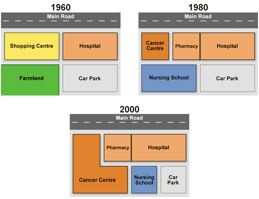
These three maps illustrate the variations that have designed during the construction of Queen Marry hospital into a newer building from 1960 to 2000.
The first table represents that the construction was divided into four parts including a shopping centre, hospital, farmland and car park which are bolded in the first year.
In comparison to the other development section,we notice that the cancer station and pharmacy were replaced by the shopping site on the west of the map.Meanwhile,the nursing school was
also
added to Linking Words
this
vast equipment obviously in 1980.
Since 2000 it was manufactured as a complex hospital, in which cancer's location was the most important part there,was regarded for approximately half of the chart,Linking Words
while
the main road was still stabled in its own place.
In the picture,after 1980 ,the plan was changed by a significant margin,so it is shown that the farmland was omitted from the table .Linking Words