
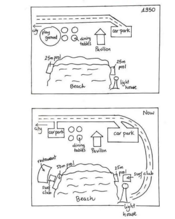
The provided maps illustrate the changing in the beachfront area in Australia between 1950 and today.
Overall
, these sections located near to onshore have significantly developed in terms of facilities, buildings and extending paths.
First of all, it can be seen that the street road toward the city in 1950 had a car park destination, but today Linking Words
this
road has extended through whole facilities to a lighthouse which is in close proximity to the beach. Linking Words
Furthermore
, the playground area has been varied to be another car park Linking Words
as well as
street paths access through there.
Linking Words
Subsequently
, there are several modifying facilities on the east and west, it can be apparent that it was unoccupied in these two directions in 1950. Linking Words
Nevertheless
, people have erected a restaurant and some surf clubs in order to serve in tourism. The swimming pool in the west has been expanded from 25m to 50m and another pool in the east has been unchanged next to the lighthouse remains until now.Linking Words