
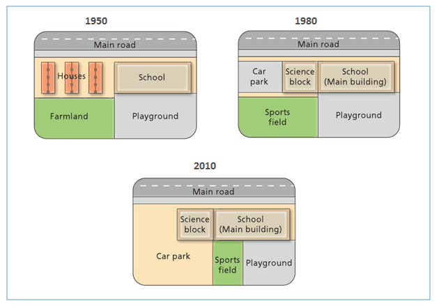
The presented map depicts the alterations that happened to West park high school from when it was constructed in 1950 until 2010.
As the diagram suggests, the institution and the main road remained stable during
this
period , Linking Words
,
Change the punctuation
apply
Linking Words
however
there was a dramatic change to the area in the vicinity of the main building.
To commence with the western side of the college , which was a residential area
in 1950 , not only divided into two parts but Add a comma
,however
also
replaced with a car park and science block
in 1980. Linking Words
furthermore
, the farmland which is in the southwest segment was turned into a sports centre, and the playground stayed constant till 1980.
In 2010, not only the sports field became smaller but Linking Words
also
it was taken up by Linking Words
parking
lot which was expanded from north west to south east chunk of the map. Correct article usage
a parking
whereas
, the recreation ground was only just compressed by other buildings. Linking Words
In contrast
, the main road and the academy stayed unchanged
from 1950 to 2010.Linking Words