
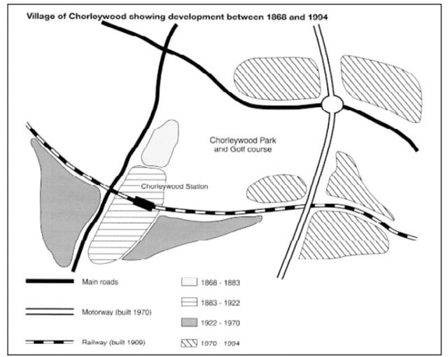
The map illustrates how the layout of a village located near London named Chorleywood changed in 4 different periods of time during the 19th century with the steady increase in its population.
It is clear that
there are various striking transformations in the whole region. It is the appearance of new infrastructures Linking Words
such
as the railway and motorway, and Linking Words
also
the expansion of the village since the rising number of residents.
As can be seen, between 1868 and 1883, Chorleywood was just a small area lying next to one of the main roads and there is a Chorleywood Park Linking Words
together with
a Golf course located in the east. From Linking Words
then
to 1922, with the installation of a railway in 1909, the village grew bigger than it used to be along the main road and a train station was built in Linking Words
this
part as well.
The place continued to be expanded along the south of the railway in the years 1922-1970. Linking Words
Moreover
, a new motorway leading from the north to the south was constructed in 1970 resulting in a larger expansion. From 1970 to 1994, the region developed and covered most of the areas surrounding the motorway.Linking Words