
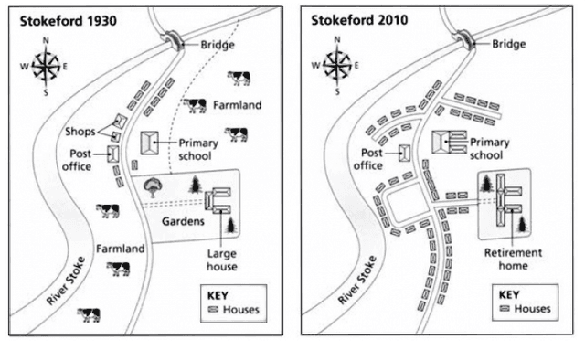
The graphs indicate the progress of the Stokeford village during an 80-year interval.
Overall
, it is explicit that at Linking Words
first,
the village was more traditional with few inhabitants and subsequent to the modifications it became a residential place.
In 1930, what stands out from the scheme is that in Linking Words
this
year, just a few families used to live there Linking Words
according to
number of the houses. Linking Words
Also
, there were local outlets and a post office across the primary school. Linking Words
Furthermore
, at the east-north and west-south sides of the large house were farmlands where cows were grazing.
After the developments, it can be seen that in 2010, all the farmlands were removed with the aim of constructing new houses along the main road and new auxiliary roads. Linking Words
Additionally
, the large house was converted to a place for retirees, Linking Words
however
, trees remained in the same place. As the final changes, shops were completely removed; Linking Words
while
some new buildings were added to the primary school.Linking Words