
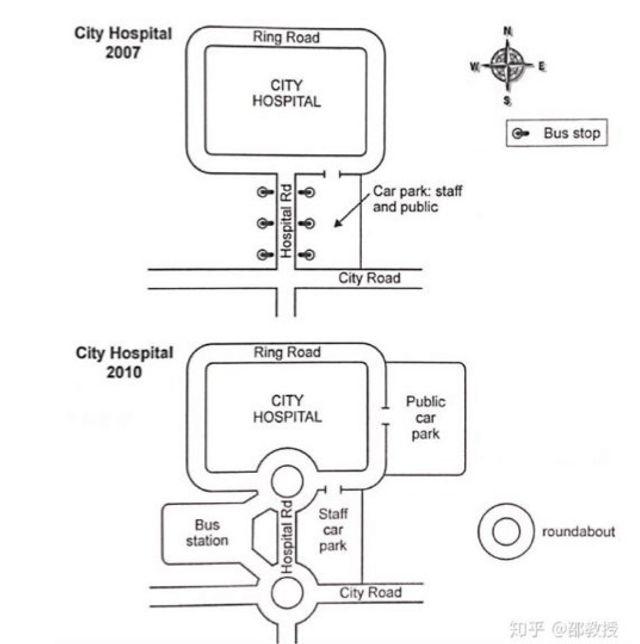
The two charts below show how the city hospital's access path was changed during 2007-2010.
Overall
, many developments were raised Linking Words
such
as the bus station, car park and roundabout, Linking Words
besides
that, the ease increased.
Linking Words
Firstly
, in 2007, the sides of the route were bus stops provided for the crowds who did not have any vehicles. Staff and public visitors were able to park their cars on the right side. Linking Words
However
, it was only available for the employers, Linking Words
furthermore
, the visitors' parking lot was removed to the east of the hospital in 2010.
Linking Words
Secondly
, roundabouts were built at each end of the access path for individuals who were solely wanting to drop their passengers off and one of them was the way to the city route. Linking Words
Moreover
, the bus station which was linked by the roundabouts was shifted to the left of the road. Linking Words
Nevertheless
, behind the hospital, the crowds were able to whirl the place through the Ring Road both in 2007 and 2010.Linking Words