
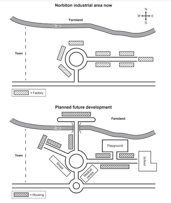
The diagram illustrates data about the map of the Norbition industrial
area
in comparison between today and the future. Use synonyms
Overall
, it can be seen that in the plan for future development, all factories will be replaced by housing and public Linking Words
area
.
At the present, the Nortabition is the industrial sector located south of the Use synonyms
river
and on the right Use synonyms
side
of the city. Use synonyms
This
Linking Words
area
is occupied by a factory Use synonyms
that is
located near the road. Linking Words
In addition
, there is only a farm on the other Linking Words
side
of the Use synonyms
river
without a bridge.
In the future, the entire city building will expand. A new road was constructed on the left Use synonyms
side
of the city, where none previously existed. More buildings for public use will be placed on Use synonyms
this
site Linking Words
such
as schools, medical centres and schools. Linking Words
Furthermore
, on the opposite Linking Words
side
of the Use synonyms
river
, a bridge will be built across the Use synonyms
river
to increase the housing Use synonyms
area
.Use synonyms