
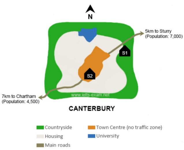
the map depicts a projection of the
town
of Canterbury, and the distance from the Use synonyms
Town
Use synonyms
centre
into Stury and Use synonyms
Chartham
, Use synonyms
hence
, by adding Two sites for the school, Linking Words
furthermore
, the maps involve four places Countryside housing, Main roads, the Linking Words
Town
Use synonyms
centre
and university.
Use synonyms
overall
, as we see in the maps from the top of the view, housing is surrounded by the countryside, Linking Words
while
in the Linking Words
town
Use synonyms
centre
, there is no traffic zone, Use synonyms
in contrast
, in the Linking Words
town
Use synonyms
centre
where the second school are planned for Use synonyms
this
area, as I mentioned, people they live in Linking Words
Chartham
, is about 4,500 of population, Use synonyms
also
the distance in the main roads is 7 KM from Linking Words
Chartham
S2, Use synonyms
whereas
, the First School 1 will Build in a countryside, is a Bit close for housing,university, and Sturry, Linking Words
otherwise
, the population in Sturry is biggest than Linking Words
Chartham
, is 7000 of inhabitance, Use synonyms
moreover
. the Main roads are the smallest in Linking Words
this
area and there are a lot of facilities.Linking Words