
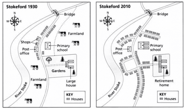
The maps illustrate the changes that took place in a rural
area
called Stokeford in the span of eighty years.
Use synonyms
Overall
, it can be seen clearly that over Linking Words
this
period of time, a small village transformed into a developed Linking Words
area
Use synonyms
whereas
the whole farmland is replaced by the household Linking Words
area
.
Use synonyms
Accordingly
, in 1930, most of the land is used for agricultural purposes which contains a large building Linking Words
along with
a garden. The Linking Words
area
between the two roads had a post office and some shops Use synonyms
along with
the fields. Linking Words
Additionally
, there was a primary school in front of the stores.
In the developed map, we can observe that, there were quite a lot of changes occurred which had improved the layout of the internal road where more no. of buildings constructed which had access for vehicles. The house is replaced by an old age home. The key houses, bridge, post office and the river stoke road remained the same.Linking Words