
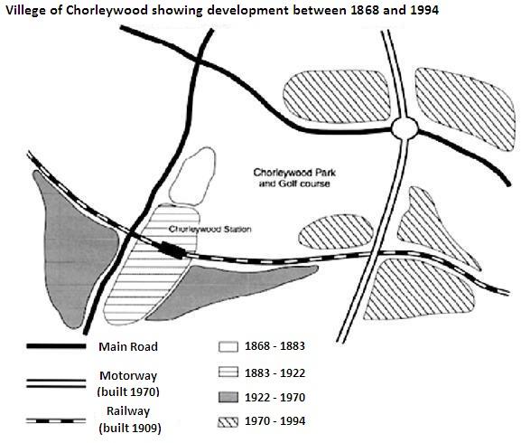
The given map depicts the infrastructure growth of Chorleywood village during the tenure from 1868 to 1994. Beginning from 1868 the center marked a steady uplift in the expansion of transport systems.
Overall
, it is obvious that the suburb developed systematically in every decade and achieved a well transportation facilities Linking Words
at the end
of 1994.
As is presented in the map, there were all transportation paths covered in the Chorleywood garden. A huge area is separated by the Golf course and the Linking Words
initially
built Main Road in 1868 passed through the west and north directions of the lawn. In 1909, at the south of the Linking Words
,
playground a well-designed railway station started functioning passing below to main road and motorway on the east side of the Park.
Remove the comma
apply
On the other hand
, gradual developments inside the centre have Linking Words
also
been attractive and well-maintained since 1868. The expansion of the grass field to the southwest of the garden was created between 1922 to 1970 and was the only long-term project in the history of Chorleywood Village. It is crystal clear that an organized visionary was behind the steady growth of the infrastructure development of Linking Words
this
suburb.Linking Words