
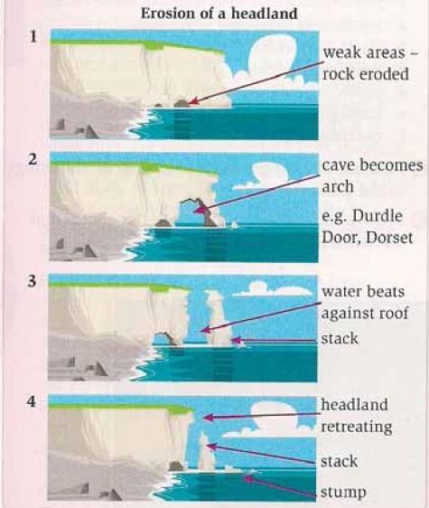
The chart gives information about the procedure of changing the foreland to rock stack and stump and new headland, which has a smaller size, by erosion.
Firstly
, the topography of erosion can happen if the part of the cliff needs to be in the water and has some infirm rock zone. Whereat, the weak rock part is eroded by water and Linking Words
then
become a beautiful arch cave Linking Words
that is
one of the famous tourist attraction Linking Words
such
as Durdle Door in Dorset.
After that, the hole is continuously expanding, but it takes a very long time until each side of the cave separates from the other. Eventually, the peak of the headland retreated Linking Words
while
the peak of the stack (the broken part that separated) fell down to some stumps.
Linking Words
Overall
it can be seen that every foreland in the sea or water source is gradually being eroded and turning into stacks and stumps Linking Words
then
becoming smaller.Linking Words