
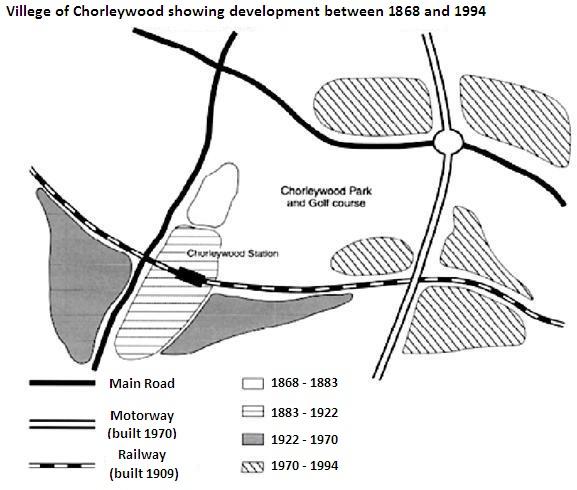
The map illustrates how a village called Chorleywood developed over a period of 126 years.
Overall
, it saw considerable growth, both in the establishment of new residential areas and transportation routes, which occurred over four phases.
From 1868 to 1883 there were only two main roads in the region covering a small area along one of them. Over the next 40 years, the centre grew southward alongside the road and a rail line was built in 1909 passing through Linking Words
this
part. Chorleywood station is Linking Words
also
located in Linking Words
this
area of the village.
Over the period between 1922 and 1970, the track was the line along which Chorleywood expanded, both towards the east and west. Linking Words
However
, a motorway was constructed in 1970 parallel to one of the main roads and Linking Words
further
development of the suburb occurred around its intersections with the other main road and the railway between 1970 and 1994. Linking Words
Furthermore
, the Park and Golf Course are now located in an area enclosed by the two main roads, the railway and Linking Words
this
motorway.Linking Words