
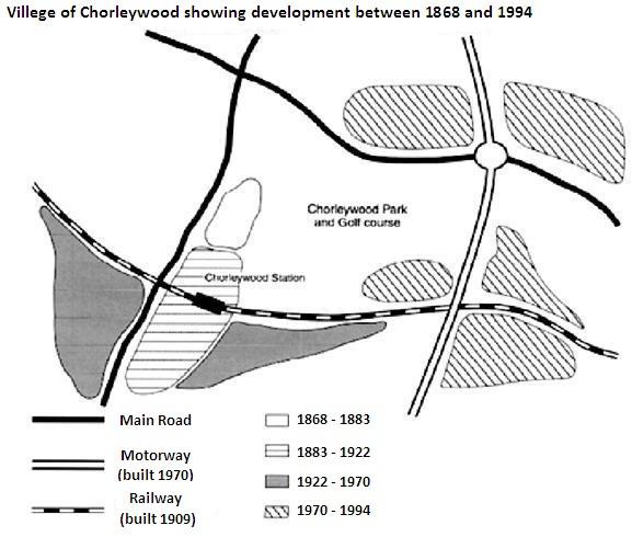
The provided map delineates the transformation of
Chorleywood
, a village near London, from 1868 to 1994, with steadily increased population density since the middle of the 1800s.
Use synonyms
To begin
with, the development of Linking Words
Chorleywood
cumulatively spread throughout the region Use synonyms
along with
the newly constructed motorway and railway.
In detail, the initial refinement was built between the West Main Road and Linking Words
Chorleywood
Park and the Golf course from 1868 to 1883, before it expanded to the south, which is where Use synonyms
Chorleywood
Station is located. Use synonyms
Furthermore
, 1992 witnessed its extension adjacent to the rail track which was added in 1909. After 48 years, a motorway was created on the East side of the countryside, which Linking Words
then
created two 4-way intersections with both the main street and the railway. Linking Words
In addition
, an extra betterment was introduced in five areas that were spread along the intersections. Three of them were spotted around the Southeast intersection, Linking Words
while
the other two were apparent on the upper side of the Northeast intersection.Linking Words