
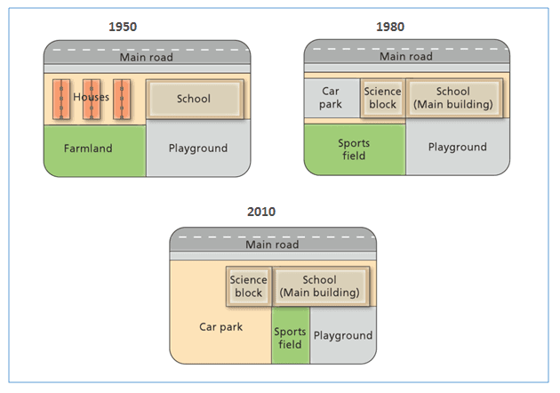
From the diagrams, we can see how West Park Secondary School have been modernised since its erection in 1950. The chart gives three representations of the institution and the area nearby within the years 1950, 1980 and 2010.
The school was built in 1950 in front of the main road on the right of some houses and farmland which,
according to
the data, was rear to the buildings. Linking Words
Furthermore
, annexed to the institute there was a playground, which was located behind the institute.
Linking Words
According to
the maps, after thirty years, the houses have been replaced by a car park and the main building has been renovated with a new science block, both in front of the main road. Linking Words
In addition
, in 1980 a sports field, which is always on the right of the playground, took the place of the farmland.
Linking Words
Lastly
, in 2010 few modifications have been executed. Linking Words
For instance
, the car park has been extended to a larger area taking up room from the sports field. Linking Words
Moreover
, the sports area has been scaled down Linking Words
as well as
the playground, either located on the bottom part of the map behind the school.Linking Words