
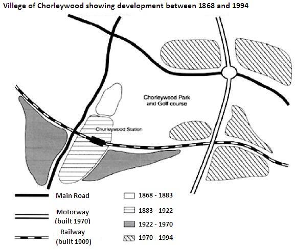
The map illustrates the changes which have taken place in Chorleywood from 1868 to 1994.
Overall
, the hamlet experienced a heavy expansion in terms of its settlement area. Linking Words
In addition
, it Linking Words
also
opened up some new transportation networks and facilities (road, railway, and station).
Linking Words
Firstly
, a significant steady expansion occurred in the centre to accommodate the population growth. Between 1868 and 1883, the suburb took only a small place on the west side, exactly on the right side of the main road. From that period until 1922, the place Linking Words
then
developed Linking Words
further
by extending southward.
Linking Words
Then
, it was enlarged horizontally by two areas in the south of the railway until 1970, responding to the construction of their station, Chorleywood Station, which extends from the west to the east side Linking Words
which
was built in 1909. Correct word choice
and
Lastly
, the newest expansion happened on the north and east sides with five settlement areas, divided by a motorway extending from north to south which was introduced in 1970.Linking Words