
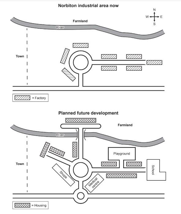
The given two maps illustrate the present Norbiton industrial zone and the proposal for its upcoming development.
Overall
, at first glance, it can be seen that in the new planning, all the factories are going to be removed and new infrastructures ( housing, shops, medical centre, school, and a playground) will be added to the town. Linking Words
Also
, two new roads and a smaller circular road will be constructed.
Linking Words
To begin
with, the first map constitutes eight factories close to the roads. In the middle of the town, there is a track, which is circled shaped, extending towards the south and the east. There are three factories around the ring-shaped roadway and five industries surrounding the pavement to the east. There is a river toward the north as well, beside which farmland is located.
Linking Words
In contrast
, in the new proposal for the city, there will be no industries, which are going to be replaced with other structures Linking Words
such
as housing, shopping malls, a healthcare centre, a playing ground for the children, and a school. One more striking change is that the circular expressway will be Linking Words
further
developed to the north Linking Words
while
crossing the river through a bridge. Linking Words
In addition
to Linking Words
this
, there will be another tiny circular road, which will be located in the south. Linking Words
Furthermore
, one more pavement will be created, closer to the west of the city.Linking Words