
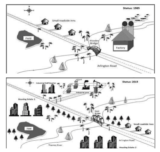
These maps distinctively illustrate to us the difference in the local industrial village of Stamdorf in three decades.
Overall
, the village became more residential and the factory expanded itself.
In 1985, the factory was in the east of the village and it was quite small. The bridge that helped to cross the river was in Arlington Road and it was made of wood. In comparison to 1985, there weren't any housing estates, in 2015 there were plenty of them. Linking Words
Moreover
, near the main road on the north side, the small inns were placed, and across them was just a field.
Linking Words
In contrast
, in 2015 it witnessed significant changes. The manufacturing complex was replaced on the north side of the small town and it was reconstructed. Linking Words
Next,
near the factory itself and close to the field, and Arlington Road were places for residents to live. The bridge Linking Words
also
was rebuilt, it was made of different materials rather than wood and got biggerLinking Words