
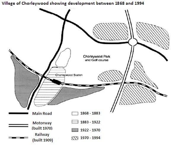
Map displays Chorleywood village was developed between 1868 and 1994.
Overall
, it can be clearly seen that after the population increased in the 19th century. there are more routes and neighbourhoods than before.
Linking Words
To begin
with the dark green and green area, the former was built in the west of the map from 1868 to 1883 which is the first residential zone in Linking Words
this
village. The latter was constructed in the south of the dark green from 1883 to 1922, and both of them were connected by the main road. After the railway and Chorleywood station were constructed in 1909, both sides of the grey villages constructed Linking Words
in
1922 to 1970 were linked together.
Moving on to the largest neighbourhood in Change preposition
from
this
town, the orange area was built from 1970 to 1994, and it covered Linking Words
northeast
of the map. Many of the orange zones were joined because of the construction of the motorway in 1970.Correct article usage
the northeast